


Wilson & Greene Counties--Wilson City PUMA, North Carolina
About
Outline

Summary
| Unique Area Identifier | 193628 |
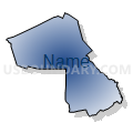
| Name | Wilson & Greene Counties--Wilson City PUMA |
| State | North Carolina |
| Area (square miles) | 640.13 |
| Land Area (square miles) | 634.10 |
| Water Area (square miles) | 6.03 |
| % of Land Area | 99.06 |
| % of Water Area | 0.94 |
| Latitude of the Internal Point | 35.61554240 |
| Longtitude of the Internal Point | -77.81476360 |
Maps


Graphs
Select a template below for downloading or customizing gragh for Wilson & Greene Counties--Wilson City PUMA, North Carolina


Neighbors
Neighoring Public Use Microdata Area (by Name) Neighboring Public Use Microdata Area on the Map
- Johnston County PUMA, NC
- Lenoir, Onslow (North) & Jones Counties PUMA, NC
- Nash & Edgecombe Counties--Rocky Mount City PUMA, NC
- Pitt County--Greenville City PUMA, NC
- Wayne County PUMA, NC
Top 10 Neighboring County (by Population) Neighboring County on the Map
- Johnston County, NC (168,878)
- Pitt County, NC (168,148)
- Wayne County, NC (122,623)
- Nash County, NC (95,840)
- Wilson County, NC (81,234)
- Lenoir County, NC (59,495)
- Edgecombe County, NC (56,552)
- Greene County, NC (21,362)
Top 10 Neighboring County Subdivision (by Population) Neighboring County Subdivision on the Map
- Winterville township, Pitt County, NC (46,280)
- Wilson township, Wilson County, NC (42,775)
- Rocky Mount township, Nash County, NC (16,257)
- Taylors township, Wilson County, NC (9,001)
- O'Neals township, Johnston County, NC (8,868)
- Saulston township, Wayne County, NC (7,676)
- Ayden township, Pitt County, NC (7,525)
- Farmville township, Pitt County, NC (6,703)
- Arthur township, Pitt County, NC (6,050)
- Moseley Hall township, Lenoir County, NC (5,715)
Top 10 Neighboring Place (by Population) Neighboring Place on the Map
- Wilson city, NC (49,167)
- Sharpsburg town, NC (2,024)
- Maury CDP, NC (1,685)
- Snow Hill town, NC (1,595)
- Kenly town, NC (1,339)
- Elm City town, NC (1,298)
- Lucama town, NC (1,108)
- Stantonsburg town, NC (784)
- Black Creek town, NC (769)
- Hookerton town, NC (409)
Top 10 Neighboring Unified School District (by Population) Neighboring Unified School District on the Map
- Johnston County Schools, NC (168,878)
- Pitt County Schools, NC (168,148)
- Wayne County Public Schools, NC (122,623)
- Nash-Rocky Mount Schools, NC (106,786)
- Wilson County Schools, NC (81,234)
- Lenoir County Schools, NC (59,495)
- Edgecombe County Schools, NC (45,606)
- Greene County Schools, NC (21,362)
Top 10 Neighboring State Legislative District Lower Chamber (by Population) Neighboring State Legislative District Lower Chamber on the Map
- State House District 26, NC (95,937)
- State House District 9, NC (88,399)
- State House District 11, NC (78,345)
- State House District 10, NC (77,125)
- State House District 23, NC (75,657)
- State House District 25, NC (73,935)
- State House District 8, NC (69,997)
- State House District 24, NC (62,129)
Top 10 Neighboring State Legislative District Upper Chamber (by Population) Neighboring State Legislative District Upper Chamber on the Map
- State Senate District 12, NC (210,500)
- State Senate District 5, NC (183,899)
- State Senate District 10, NC (181,431)
- State Senate District 11, NC (177,074)
- State Senate District 3, NC (167,669)
Top 10 Neighboring 111th Congressional District (by Population) Neighboring 111th Congressional District on the Map
- Congressional District 2, NC (741,576)
- Congressional District 3, NC (735,979)
- Congressional District 1, NC (635,936)
Top 10 Neighboring Census Tract (by Population) Neighboring Census Tract on the Map
- Census Tract 14, Wilson County, NC (8,885)
- Census Tract 4, Wilson County, NC (8,028)
- Census Tract 16, Pitt County, NC (7,843)
- Census Tract 9503, Greene County, NC (7,380)
- Census Tract 6, Wilson County, NC (7,282)
- Census Tract 1.01, Wayne County, NC (7,215)
- Census Tract 401, Johnston County, NC (6,942)
- Census Tract 115, Nash County, NC (6,939)
- Census Tract 402.01, Johnston County, NC (6,342)
- Census Tract 3.03, Wayne County, NC (6,326)
Top 10 Neighboring 5-Digit ZIP Code Tabulation Area (by Population) Neighboring 5-Digit ZIP Code Tabulation Area on the Map
- 27834, NC (52,914)
- 27893, NC (39,723)
- 27534, NC (31,364)
- 28590, NC (23,407)
- 27801, NC (21,740)
- 28504, NC (21,642)
- 27803, NC (21,227)
- 27896, NC (20,130)
- 28551, NC (14,093)
- 28580, NC (12,657)